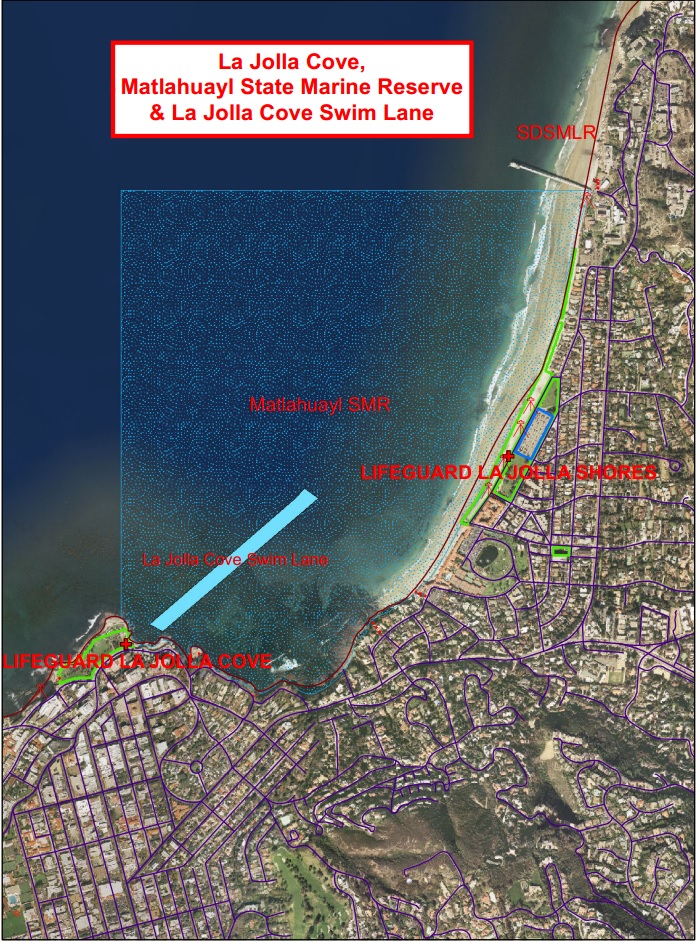
The Lat/Lon of the NE end of the swim lane is approximately N 32 51’20” / W 117 15’57”. This waypoint was taken from Google Earth, which uses the WGS-84 Datum. If your GPS is set to NAD-83 Datum, you will need to change it to WGS-84. If you paddle out from the LJ Shores launch point at the end of Avenida De La Playa at a 275 degree magnetic bearing, you should see the marker buoy on your left that is the NE end of the swim lane.
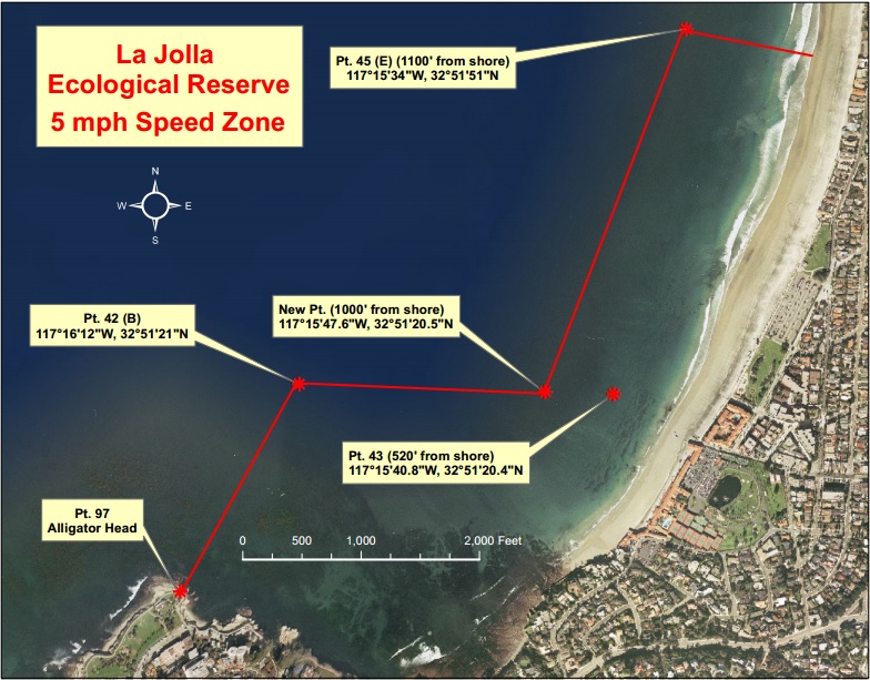
This map shows the lower east-west boundary line of the Reserve 5 mph speed zone that is also the northern line of the swim lane. Kayaks are allowed in all areas of the Reserve, except the swim lane, the swimming-only areas of the beach, and the area between the caves and the cove, which is marked by a neon buoy.
My thanks to John Sandmeyer, Marine Safety Lieutenant, City of San Diego Fire Rescue Department for supplying these maps.
This post will be later moved to the Safety Articles Group.