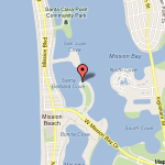
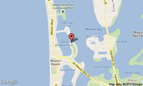
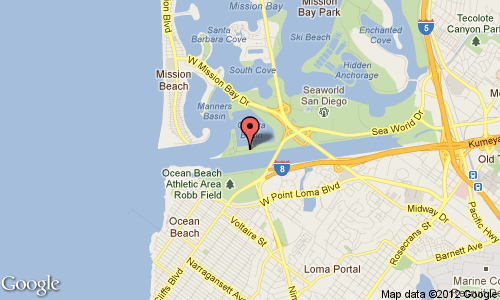
Mission Bay – Bahia Point
 Launch: easy access to sandy beach areas off of the service road along Bahia Hotel
Parking: several single slots along the service road, full on weekends
Access: middle of Mission Bay – flat water – can paddle in many directions.
Conditions: great for flatwater workouts, several surf skiers and S.U.P. launch from this stretch
Bathrooms: one building along the street, if locked the nearest is in the park at the cove
Notes: boat traffic in the middle of the channel and avoid the swim area in the cove
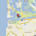
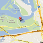
Mission Bay – Aqua Adventures Dock
 Launch: use of Aqua Adventure’s dock when the shop is open.
Parking: Large lot adjacent to the shop
Access: west end of Mission Bay – flat water – can paddle in many directions. Easy access to Mission Bay channel and the open ocean.
Conditions: great for flatwater workouts, or starting point of coastal paddles
Bathrooms: available when the shop is open
Notes: a deli is located next door. Wednesday morning workout paddles leave from here
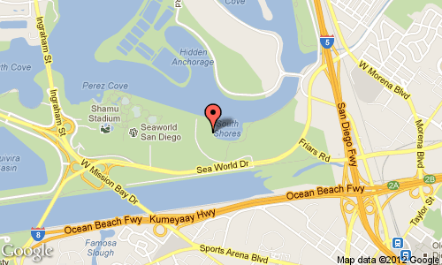
Mission Bay – South Shores
 Launch: concrete boat ramp
Parking: large lot adjacent to ramp, usually open
Access: southeast end of Mission Bay – flat water – can paddle along Fiesta Island and Sea World Conditions: great for flatwater workouts
Bathrooms: building adjacent to the parking lot
Notes: boat traffic – jet skiers often use this stretch of Mission Bay
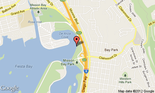
Mission Bay – De Anza Cove
 Launch: concrete boat ramp
Parking: large lot adjacent to ramp, usually open
Access: northeast end of Mission Bay – flat water – can paddle along Fiesta Island and Campland Conditions: great for flatwater workouts
Bathrooms: building adjacent to the parking lot
Notes: boat traffic – waterskiers often use this stretch of Mission Bay
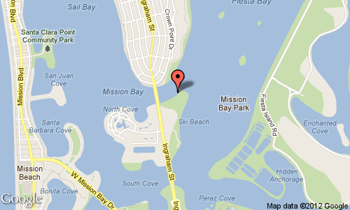
Mission Bay – Vacation Island
 Launch: small beach at the northeast end
Parking: large lot at the northeast end
Access: middle of Mission Bay – flat water – can paddle in several directions
Conditions: great for flatwater workouts
Bathrooms: adjacent to the parking lot
Notes: motorized boat traffic, crew teams, and sailboats frequent this area. Ski Beach at the southeast end where a boat ramp is located – avoid it and jet skis.
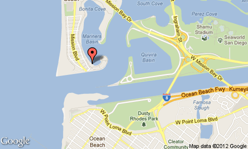
Mission Bay – Mariner’s Basin
 Launch: easy access to the sandy beach area.
Parking: small lot adjacent to park, often full on weekends
Access: west end of Mission Bay and Mission Bay channel
Conditions: great for flatwater workouts. Mariner’s Basin is a great spot for skills practice
Bathrooms: available at the nearby park
Notes: avoid the swim area in the cove
San Diego Bay – Shelter Island
 Launch: easy access to the sandy beach area, next to a busy boat ramp
Parking: lot adjacent to the boat ramp. Do not use the boat trailer parking spots.
Access: north end of San Diego Bay and Pt. Loma
Conditions: varied
Bathrooms: available near the boat ramp
Notes: dangerous large boat traffic (shipping lane) in San Diego Bay
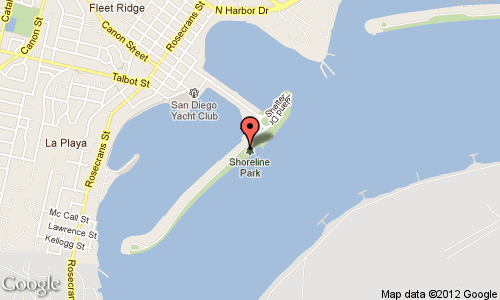
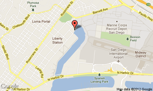
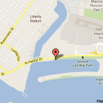
San Diego Bay – Liberty Station
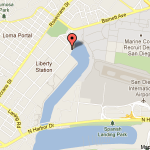 Launch: concrete boat ramp
Parking: small lot adjacent to Corvette Diner and stores
Access: north end of river channel leading to San Diego Bay
Conditions: easy paddle out the channel, conditions are rougher in San Diego Bay
Bathrooms: a short walk south to the park
Notes: slippery ramp-be careful! dangerous large boat traffic (shipping lane) in San Diego Bay, rougher and windier in bay
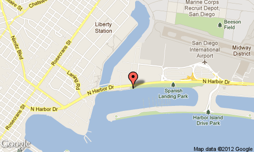
San Diego Bay – Harbor Island
 Launch: easy access to the sandy beach area
Parking: small lot next to the beach
Access: north end of San Diego Bay and Liberty Station channel
Conditions: varied once you leave the Harbor Island marina
Bathrooms: available during park hours
Notes: motorized boat traffic, dangerous large boat traffic (shipping lane) in San Diego Bay
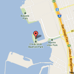
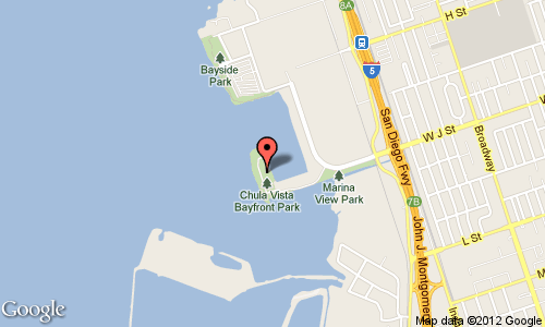
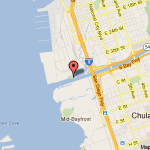
San Diego Bay – Chula Vista
 Launch: concrete boat ramp
Parking: large lot adjacent to the boat ramp
Access: southern end of San Diego Bay, turtle coves to south, cross to Coronado Cays.
Conditions: easy flatwater conditions, wind, and chop later in the day.
Bathrooms: adjacent to the parking lot
Notes: some motorized boat traffic when leaving the harbor
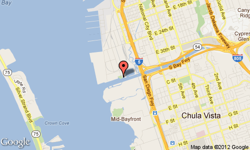
San Diego Bay – National City
 Launch: concrete boat ramp in Pepper Park
Parking: small lot adjacent to the ramp
Access: San Diego Bay area south of the bridge, paddle along the Navy fleet, or cross to Coronado Cays.
Conditions: flat water sometimes windy and choppy.
Bathrooms: in Pepper Park adjacent to the parking lot
Notes: some boat traffic using the channel to the bay, fishing lines, YMCA boat camp, afternoon wind, and chop.
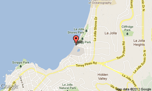
La Jolla Shores
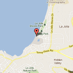 Launch: sandy beach boat ramp
Parking: on-street parking or parking lot about 1/4 mile away
Access: La Jolla Cove & Caves, various coastal paddles, Marine Room surf spot
Conditions: varied. Usually a mild surf launch/landing.
Bathrooms: adjacent to the nearby park, with rinsing showers
Notes: a very popular kayaking and swimming spot. During the summer, parking can be very difficult. This site is used by several kayak rental companies and the launching and landing can become congested. Be aware of swimmers entering the launch zone.
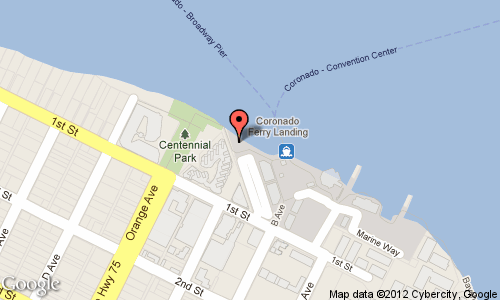
Coronado – Ferry Landing
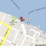 Launch: small sandy beach at the north end
Parking: small lot on the north end, sometimes full on weekends
Access: middle of San Diego Bay – busy area. The charm of this launch site is all the restaurants, take-out foods, tourist zone
Conditions: flat water with wind, chop, and lots of large ships.
Bathrooms: in the shopping complex
Notes: ferry route and lots of large ships. The Navy has no paddle zones near their bases and ships.
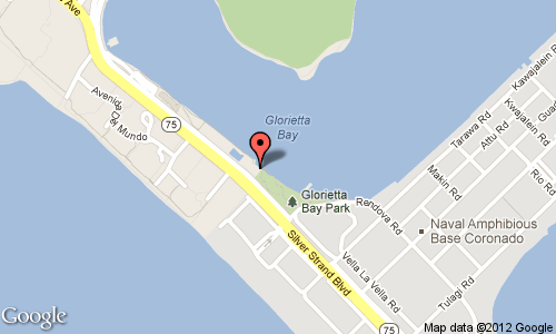
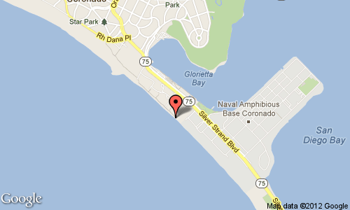
Coronado – Glorietta Bay
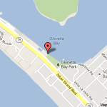 Launch: boat ramp – drive down Strand and turn into the access road by Municipal Pool. Ramp and a small parking lot at the southern end of the pool complex.
Parking: lot – can fill up on weekends
Access: middle of San Diego Bay – busy area, the bridge is spectacular. Can paddle north or south of the bridge, or cross to downtown.
Conditions: flat water with wind, chop, and lots of large ships.
Bathrooms: in park
Notes: Ferry, large ships, and the Navy has no paddle zones near their ships and bases.
Coronado – Beach
 Launch: beach
Parking: limited on-street parking and a small lot.
Access: Pacific Ocean. This is often the starting point for the Coronado Circumnavigation paddle
Conditions: varied.
Bathrooms: Public restroom at the Coronado Cays Park
Notes: No need to stop at the guard shack for entry.
 Launch: beach
Parking: limited on-street parking and a small lot.
Access: Pacific Ocean. This is often the starting point for the Coronado Circumnavigation paddle
Conditions: varied.
Bathrooms: Public restroom at the Coronado Cays Park
Notes: No need to stop at the guard shack for entry.
Coronado Cays
 Launch: This beach is now closed
Launch: This beach is now closed To paddle the south bay, launch at the Chula Vista boat ramp, info is found above in this list.
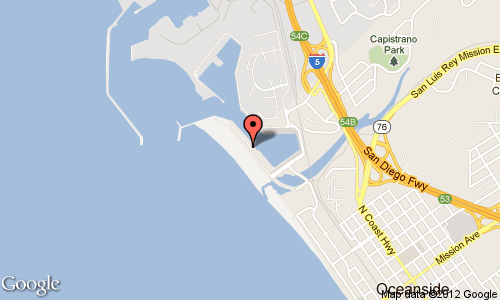
Oceanside Harbor
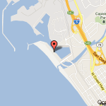 Launch: boat ramp – drive down North Pacific Street to the boat ramp.
Parking: lot – can fill up on weekends
Access: Oceanside harbor and the open ocean.
Conditions: flat water within the harbor, varied ocean conditions outside the harbor.
Bathrooms: –
Notes: To the north of the harbor is Camp Pendleton Marine base, landing is not allowed.
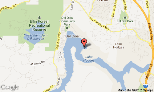
Lake Hodges (seasonal)
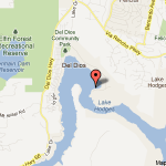 Parking: large lots
Access: The lake is large and scenic, and has a dock on the lake, picnic areas, and scenic bike or hiking.
Conditions: flatwater, wind and chop later in the day
Bathrooms: adjacent to the parking lot
Notes: seasonal (usually March thru September, open a few days during the week.) City launch fees are in effect. Many fishermen during open season.
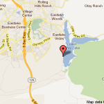
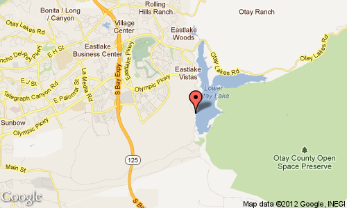
Otay Lakes (seasonal)
 Parking: large lots
Access: Lower Otay Lakes. The Lake is large and scenic, has an Olympic training dock and lanes on the lake, picnic areas, and scenic bike or hiking.
Conditions: flatwater, wind and chop later in the day
Bathrooms: adjacent to the parking lot
Notes: seasonal (usually March thru September, open a few days during the week.) City launch fees are in effect. Many fishermen during open season.
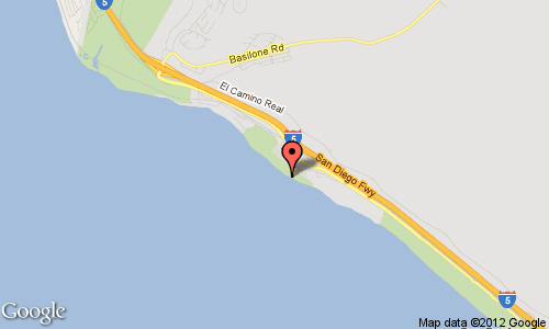
San Onofre State Beach
 Launch: beach
Parking: dirt lot – can fill up on weekends. Follow the dirt road all the way south to where it ends just before the nuclear plant. This south end is the paddle surfing area
Access: open ocean.
Conditions: flat water within the harbor, varied ocean conditions outside the harbor.
Bathrooms: Chemical toilets
Notes: If you’ve been down to San Onofre lately you may have noticed (or not) two small signs. One is the letter “O” and the other is the letter “K.” They are positioned near the drainage along the north end of Dog Patch. These signs represent the northernmost boundary by which we must not paddle beyond. The signs are staggered such that when you are out on the water, they read “OK” if you are within the boundary. If the signs read “KO” you must paddle south. Please respect this boundary so that our privilege to surf San Onofre is not jeopardized! Many of us surf right along this line and usually find ourselves lined up with board surfers. If you are a novice or are surfing a craft of limited maneuverability (i.e. a big sit-on-top), I encourage you to line up further south – away from the board surfers. Paddle surfing is also permitted along the entire stretch of beach south of the power plant, down to Camp Pendleton. These areas are accessible by trails from the main campgrounds of the state park. (via CKF)
Dana Point – Mother’s Beach
Launch: protected beach.
Parking: lot – can fill up on weekends
Access: Dana Point harbor and the open ocean.
Conditions: flat water within the harbor, varied ocean conditions outside the harbor.
Bathrooms: Nearby
Notes: There is a bit of a paddle to the harbor entrance.
Launch: protected beach.
Parking: lot – can fill up on weekends
Access: Dana Point harbor and the open ocean.
Conditions: flat water within the harbor, varied ocean conditions outside the harbor.
Bathrooms: Nearby
Notes: There is a bit of a paddle to the harbor entrance.
If we have missed your favorite launching spot, send us an email. For other kayaking spots, visit the California Kayak Friends website or Paddle California.