-By Robin Kedward
As Sea Kayakers in Southern California, most of our paddles are close to shore on the ocean, or in our beautiful bays. When we venture beyond the close proximity to shore, we need to know how to navigate using the magnetic compass and a map (called a “chart” in marine navigation). The skill of navigating our small boats on the open ocean in a straight line from one place to another takes into account the effects of tides, winds, currents, and waves. Even if you rely on a GPS to navigate, you should always have a map and compass on board as a back-up, as electronics can fail.

Following a compass bearing on an open ocean paddle. Click on photos to enlarge.
The Magnetic Compass is mounted on your boat so that it is aligned with the fore and aft line of the boat. This is called a “Lubber Line”. For taking bearings, you can then simply point your boat at an object and read the bearing. You can also do this using a hand-held bearing compass, but is less convenient on the open water. Be sure to keep metal objects away from your compass, as they can influence where the needle points.
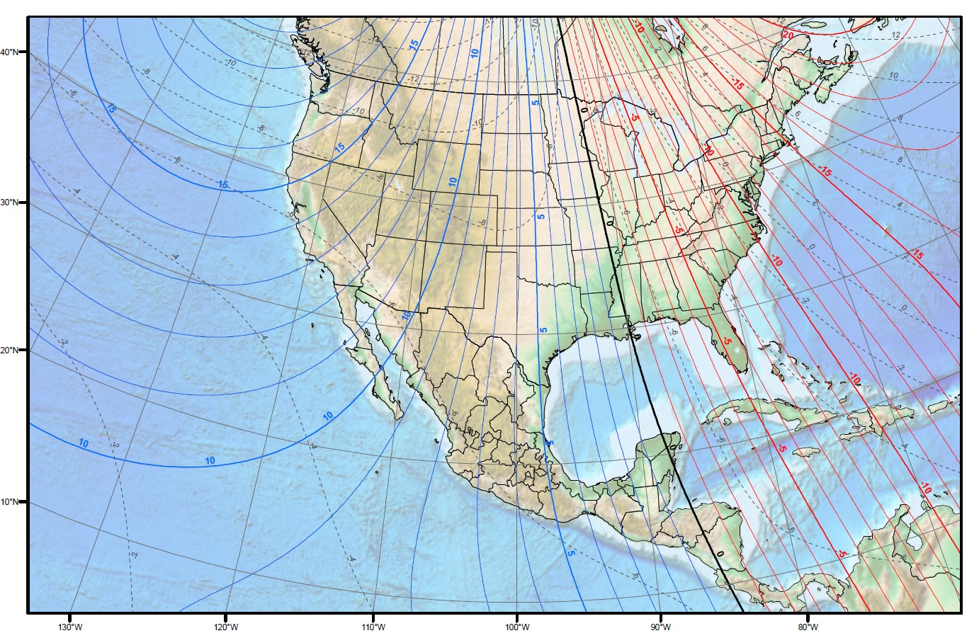
The Chart is always made oriented to True North (the left and right sides of the map borders are aligned along a north/south line), and is marked with horizontal lines called Latitude, and vertical lines call Longitude. Latitude lines are like east-west parallel slices through the earth, while Longitude lines converge at the poles, and are not parallel to each other. Both sets of lines are divided into “degrees” and “minutes”, and act as measuring tapes to tell you where you are along that line. Distance on the chart is measured off the Latitude lines. One minute of Latitude = one nautical mile. To travel one nautical mile in one hour is to travel at a speed of one knot. Be sure to place your chart in a waterproof bag and secure it to your deck in front of you for easy access. The chart on the right below shows the degree of magnetic variation across the USA with those numbered lines.
![variation_map[1]](http://www.sdkc.org/wp-content/uploads/2016/08/variation_map1.gif)
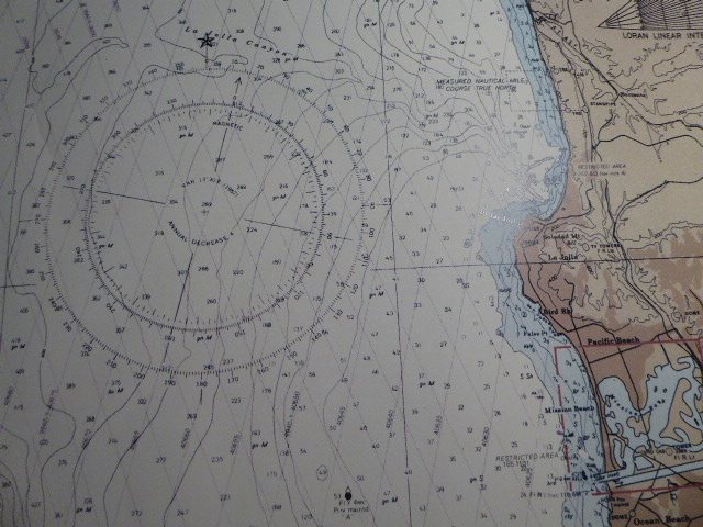
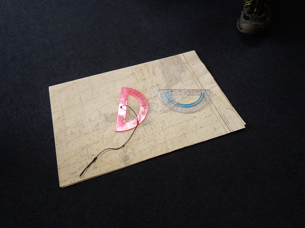
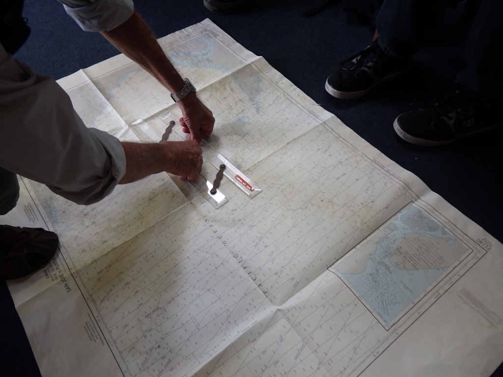
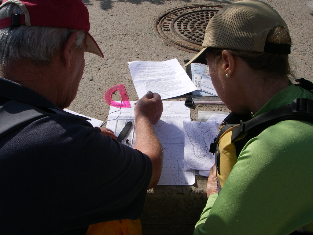
A Compass Rose can be found on the chart that has two sets of numbers on the rings, marked in degrees. The outside ring is True North, and the inside ring is Magnetic North. The needle on a compass points to a place north of Hudson Bay, Canada, and on the Southern California coast there is a difference between True and Magnetic North of about 14 degrees called “Variation” on charts and “Declination” on maps. If you take a “True North Bearing” off a chart or map to follow in your boat, you need to change it to a Magnetic Bearing to use with your compass. To do this in our area, you simply subtract 14 degrees, or “From map to act, in the west you subtract”. To go from a magnetic bearing to plotting a course of travel on the chart, you simply do the opposite, or add 14 degrees. You then place a set of Parallel Rulers over the compass rose along the bearing line, then “walk” the rulers over to the place you want to travel from/to and draw a line. You then do the same thing for the second leg, following a new bearing, and so on. That becomes your “Plotted Course of Travel”. You can do the same with a piece of string, which is not as accurate, but in the field that is better than nothing. Using a protractor with a string tied to the 90 degree point at the straight edge is a good device for the field. You align the bottom along a Lat/Lon line and move the string for your bearing line. Be sure to check your bearing number against the compass rose when doing that. You can also use the string to measure the distance of your line of travel, placing it along the Latitude scale at the bottom or top of the chart.
 And you can even use the protractor with a straw taped to it, and a weight tied to the end of the string as a crude sextant for Celestial Navigation. The protractor can be tethered to your chart bag for quick use on the water.
“Coordinates” on a chart, or a position on earth, are expressed in terms of Latitude and Longitude (“Lat/Lon”), with Latitude always the first set of numbers, which is where that point is on the east/west line. Think of it as a point in the middle of a crosshair, with the horizontal line being Latitude, and the vertical line being Longitude. As you move that crosshair around on a chart, the point is moving both north – south (Longitude), and east – west (Latitude). Another way to think of this is the x-y axis bar graph. Latitude is the horizontal x-axis, while Longitude is the vertical y-axis. A coordinate is where the two lines cross on that graph, and where the two lines cross on a chart.
Following a bearing when in sight of the shore can be helped by sighting something on shore that is in line with your bearing and direction of travel. If you can see another unique “Landmark” in line behind the first object, then keeping those two lined up to each other (front and back) means you are not drifting sideways.
Pinpointing your Position on the water or land can be done using “Triangulation”. By taking two bearings off of known landmarks, then changing them into true north bearings and drawing those lines on the chart, you can see where you are, at the point where the lines cross. If you are on a known baseline, then one bearing will show you where you are on that baseline (like a trail or road).
Tides, currents, waves and winds are the variables that affect your course of travel. Using a Tide Table to see when the best time to go in or out of a bay will make your effort more efficient. Knowing what the current is and the direction will allow you to compensate for it taking you off course. Looking at the weather and wind prediction should always be part of trip planning for safer paddling. A light cross-wind has the same effect as a cross-current, by moving your boat off your line of travel. If you do not recognize this, and do not have land features to steer to, your course of travel will be compromised unless you compensate for that. If you suspect that a sideways drift off course may happen, and you have a “Baseline” to help you, then over-steer to one side of your destination. When you hit the Baseline, you then know which way to turn to arrive at your target point. An example of this is coming into Mission Bay in a fog, with a North West wind, and the current going south. The beach is the Baseline, and you then steer well to the north of the north jetty. When you feel the swells starting to get higher under your boat, and can hear the surf, you then turn south until you see the north jetty.
These are just a few basics of navigation that you should know. Here are some resources to learn more online:
http://fer3.com/arc/imgx/bowditch1995/chapt01.pdf
http://www.differencebetween.net/science/difference-between-true-north-and-magnetic-north/
http://www.oceannavigator.com/March-April-2014/triangles-and-dividers/
http://www.working-the-sails.com/navigation_basics.html
http://www.marine-movers.com/AidsToNavigationExplained.html
http://www.freetidetables.com/sid/18125c2e/
Written up by Jay Murdock from some of the June 4th, 2016 class notes, instructed by Robin. You can read his background on our “Contacts” page.